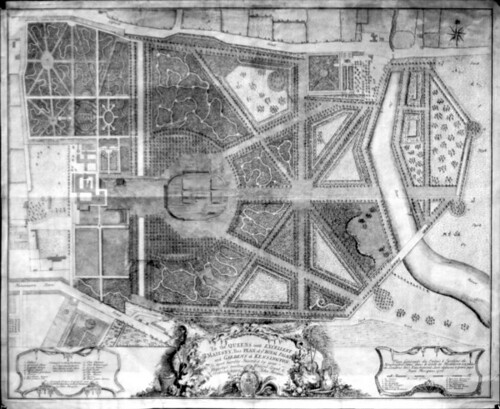
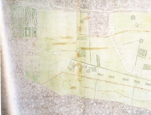
Can't fool you, can I? That's actually a map of the gardens drawn circa 1736 by John Rocque. As you can see from my previous post, they were still working the kinks out of the road system back then, much less mastering the intricacies of aerial photography.
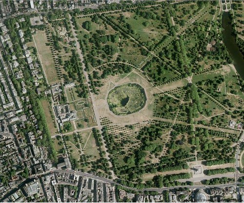
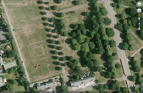
Here's how the gardens look from the air now:
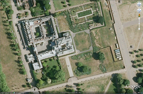
And for a close up of the Palace:
This image is dated 2010 and you can see the fence and mobile construction offices, which are preparing for the new landscape work that's currently in process. More on that later.
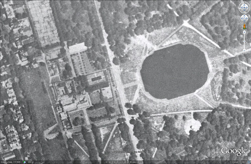
But you really can go back in time on Google Earth, in this case, only to 1945:
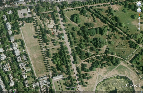
I was really interested in features from previous historic layers so I started playing around and zooming in to see what, if anything, from the Rocque plan still existed. Obviously, the bason (now colorlessly and mathematically inaccurately called the Round Pond) can still be seen, as well as the Patte d'oie or goose-foot avenues radiating out from it. The Mount is gone, and the colorful flower gardens in front of the Orangery have been turfed over (yawn), as well as the amazing parterre designs north of the Palace. But check this out:
Can you see it?
It's a helicopter! Isn't that cool? I wonder who was visiting - could have been Will and Kate scoping the place out and choosing wallpaper (they're moving in to Great Aunt Margaret's pad next year, you know), or maybe it was one of the dignitaries or Obscenely Rich People who live in one of the mansions next door. One can only speculate. But isn't that cool - and not a little bit scary - that Google Earth is so zeroed in as to catch the image of a helicopter on the ground! Good thing the Germans didn't have this technology in the 1945, what?
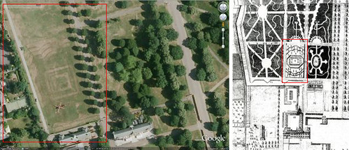
Actually, as cool as the helicopter is, what you should have noticed, and what made me exclaim, "No frickin' way!" in the computer lab, are the tell-tale scars in the lawn of a long-lost design.
 |
| You should be seeing red |
Notice the parterre design is slightly different than the 1736 plan. More contours in the middle square. Look what happens when you put it on top of the satellite image:
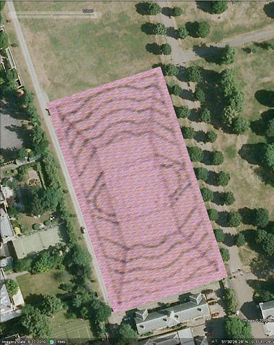 |
| It's magic! |
Wanna see that again?
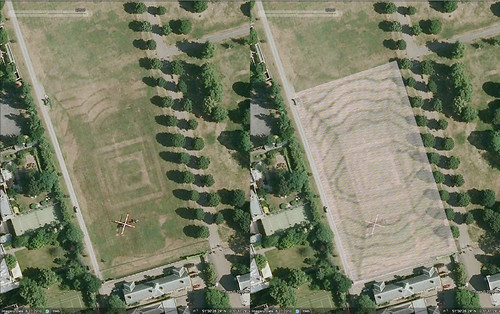 |
| Wow! |
I'm not sure when the parterres were wiped out since they appear in their various iterations into the 1800's, the central portion above changing shape to a quadrant with a central basin at some point prior to 1860. And the area in the 1945 image shows tents, maybe? We know from documentation that soldiers were encamped in the gardens during the WW2. But the scars on the lawn! You can't see these tell tale impressions at ground level. Well, I couldn't, but that whole area is fenced off at the moment so I couldn't actually get down and sniff the ground to pick up the trail, so to say.
Being a garden historian is like being a garden detective, which is really loads of fun. We try to solve landscaping mysteries such as the Case of the Disappearing Parterres, which often just conjures up more questions like: When were the parterres turfed over and why? If there were practical (i.e. military) reasons, why weren't they restored afterward? In the new redesign being implemented east of the Palace now, why were the areas to the north and south of the building ignored? And finally, if it were up to me, what would I conserve/restore/recreate and why?
Well, that was fun, wasn't it? How much you wanna bet you all go scrambling to load Google Earth searching for evidence of lost landscapes! Happy hunting!
Edited to add: My tutor, Tom Turner, sent me a link which further explains the existence of the helicopter. Seems I wasn't that far off in assuming a member of the Royal Family was visiting! I find it interesting that this bit of earth is called 'the paddock' when the original stables were due west of the palace. Hmmmm...


No comments:
Post a Comment